THE J-13 ATLAS / QUADRANT BRAVO
Two lots.
An entire lunar neighbourhood.
Explore the J-13 region using a user-supplied lunar mapping screenshot. Zoom, pan and select Lots 196 and 197. Parcel locations are reconstructed from historic novelty-deed references—not surveyed lunar property boundaries.
J-13 / Quadrant Bravo 20–24°S, 44–48°E
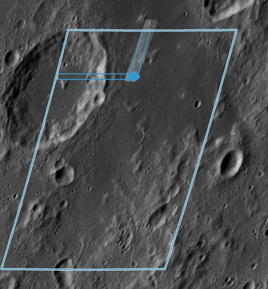
Drag to pan · Scroll or use +/− to zoom · Tap a highlighted lot
J-13 boundaryWorking gridLots 196 & 197
Base image: screenshot supplied from lunar QuickMap by the project owner. Positioning: approximate image-to-coordinate alignment using the visible J-13 corner polygon. This is a visual exploration tool, not a GIS-grade georeferenced product. The imagery is not the AI-generated poster. J-13's corner coordinates and approximate 13,636 km² area come from the supplied QuickMap inspector; parcel divisions have not been independently verified.